Newcomb & Upper Hudson Map -�1:50,000 (1″= 0.8 miles) A long awaited detail map covering the Upper Hudson River, the Essex Chain Lakes, Boreas Ponds, Henderson Lake, and the Camp Santanoni area.
Other areas that are covered include: Southern High Peaks Wilderness, Vanderwhacker Mountain Wild Forest, Hudson River Gorge, Opalescent River, Rich Lake to Harris Lake, Schroon River North of Schroon Lake.
Map is 18″ x 36″�
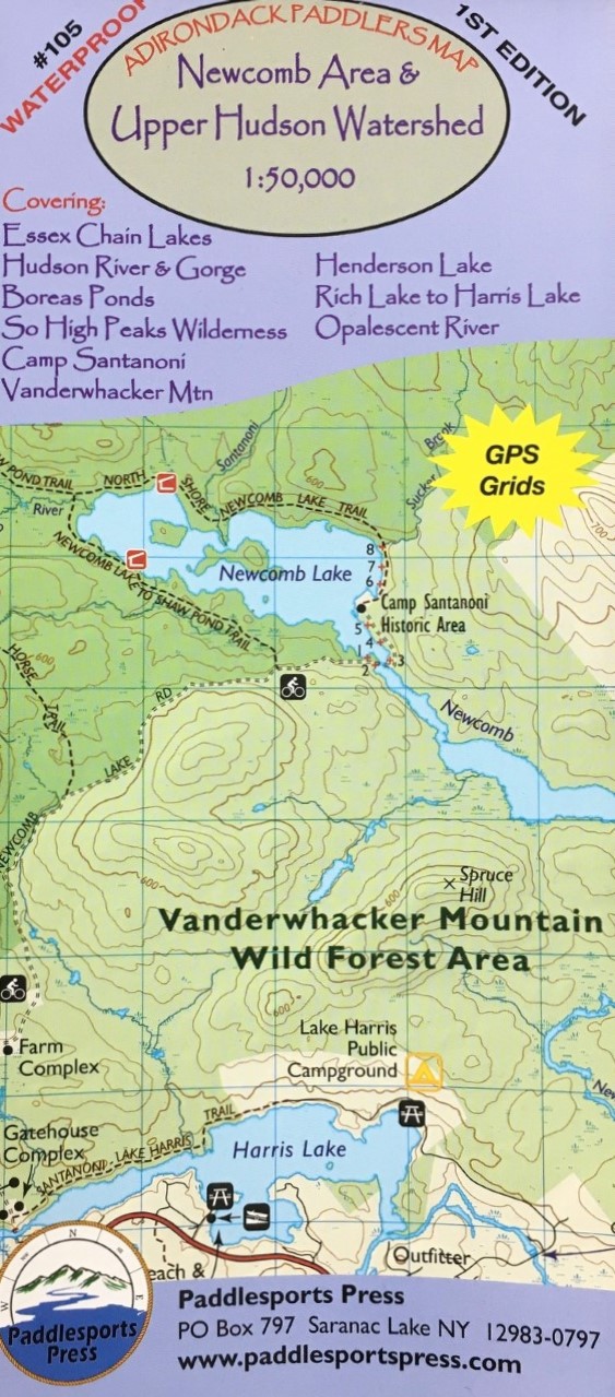
Adirondack Paddlers Map – Newcomb & Upper Hudson
$14.95