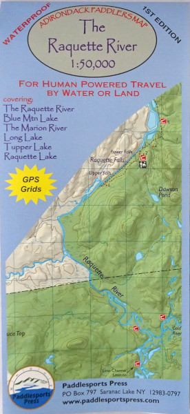
Adirondack Paddlers Map Raquette River – 1:50,000 scale. (1″= 0.8 miles) of Raquette River
Waterproof and tear-resistant material. Full color, shaded relief and topographic map at a 1:50,000 scale; 18″X24″ format folded to approximately 4″x9″. Shows private land, state land, and wilderness designated lands, in different colors. Mountains shown in shaded relief in addition to topographic lines—map is metric. Up to date portages, trails and numbered campsites. UTM Grids.
Covers these areas: Raquette River, Blue Mountain Lake, The Marion River, Long Lake, Tupper Lake, Raquette Lake.
Adirondack Paddlers Map – The Raquette River
$9.95
Raquette River Map
In stock