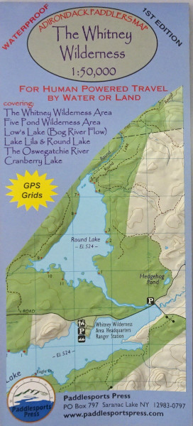
The Whitney Wilderness Map –
1:50,000 scale. (1″= 0.8 miles) of Whitney Wilderness, Five Ponds Wilderness, and Cranberry Lake area.
Waterproof and tear-resistant material. Full color, shaded relief and topographic map at a 1:50,000 scale; 18″X24″ format folded to approximately 4″x9″. Shows private land, state land, and wilderness designated lands, in different colors. Mountains shown in shaded relief in addition to topographic lines—map is metric. Up to date portages, trails and numbered campsites. UTM Grids. 1st edition, published in 2017.
Covers these areas: The Whitney Wilderness Loop, Cranberry Lake 50, Bog River Flow, Lake Lila, Round Lake, The Oswegatchie River, Five Ponds Wilderness.
Adirondack Paddlers Map – The Whitney Wilderness
$9.95
Whitney Wilderness Map
Out of stock