


Drone Photography: Rules, Ethics, and Benefits
Drone Photography: Rules, Ethics, and Benefits
The following is from the 2020 Mar/Apr edition of Adirondac Magazine
Text and Photographs by Brendan Wiltse
Drones are becoming increasingly popular, and common, consumer electronic devices. Chances are you know someone who owns a drone, or own one yourself. You have likely seen images of the Adirondacks and other parts of New York State on social media, in magazines, or on TV that were captured with a drone. The devices offer a way to see the world from a different perspective without having to be in an airplane or helicopter.
It’s not as simple as operating a “normal” camera, though. Owning and operating a drone comes with a long list of legal and ethical considerations
Rules and Regulations
Airspace in the United States is under the jurisdiction of the Federal Aviation Administration (FAA). This means that anytime you launch anything into the air, be it a plane, a model rocket, or a drone, you are subject to FAA regulations. There is a specific set of regulations for small Unmanned Aircraft Systems (sUAS), aka drones. Anyone operating a drone under fifty-five pounds must follow these regulations. Further, if you are operating for commercial or business purposes (such as selling images or services), you need to be an FAA-Certified Drone Pilot.
These rules and regulations are meant to keep our national airspace safe. They include points like being restricted to flying below 400 feet above ground level, not flying over groups of people or public events, maintaining line of sight with the drone, and the list goes on. For more on these federal regulations, visit the FAA website.
New York State laws prohibiting the use of motorized equipment in Wilderness, Primitive, and Canoe Areas provide another level of legal complexity. New York does not have jurisdiction over the airspace over the state, but it does regarding what happens on the ground. Thus it is illegal to launch or land a drone in the areas listed above. (National Parks go a step further by also banning the operation of drones from their lands, closing a loophole that would allow a drone to be launched from outside of a National Park but operated from within it. It would be prudent for the New York State Department of Environmental Conservation [DEC] to adopt this rule and further clarify the ban on drones in Wilderness, Primitive, and Canoe Areas.) State laws can be found at the DEC website.
Impacts
As with any activity taking place on public lands, it is important to consider the impact drone use may have on the resource and on other visitors. Even the quietest drones are quite loud, which can significantly affect the experience of visitors in Wilderness Areas who are specifically seeking an experience of silence and solitude. People may also feel uncomfortable with the idea of a drone taking their picture, especially if they intentionally sought out an experience or location away from other individuals. When visiting Wilderness Areas, leave your drone behind and embrace the wild experience.
Drones can also negatively affect wildlife. There is plenty of evidence that certain species of wildlife exhibit stress or alterations of behavior when a drone is near them. A quick search online will yield many examples of drone operators being irresponsible around wildlife, either intentionally harassing them or unintentionally causing stress. Drones are being used by wildlife biologists to assist in their research, and in these cases, careful consideration by well-informed professionals determines whether their operation is both safe and ethical. Unless you are a wildlife biologist engaging in scientific research, it is best to steer clear of wildlife. If you do see wildlife exhibiting stress, aggression, or any alteration in behavior immediately land your drone.
Drone Values
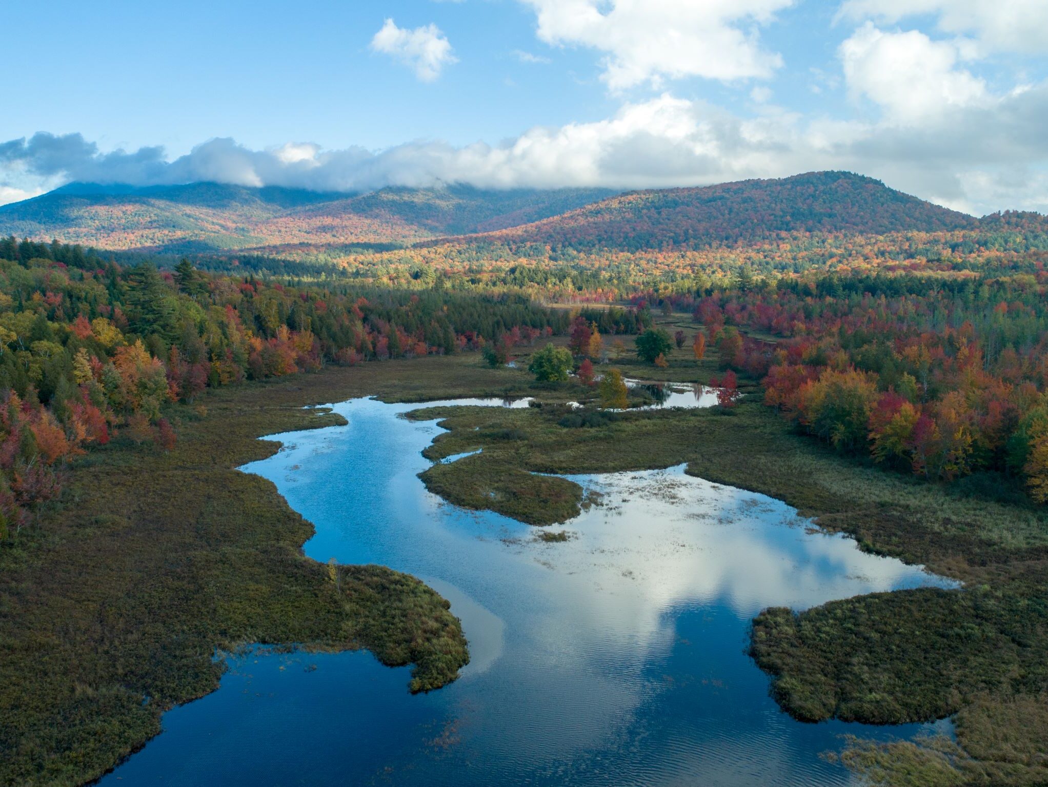
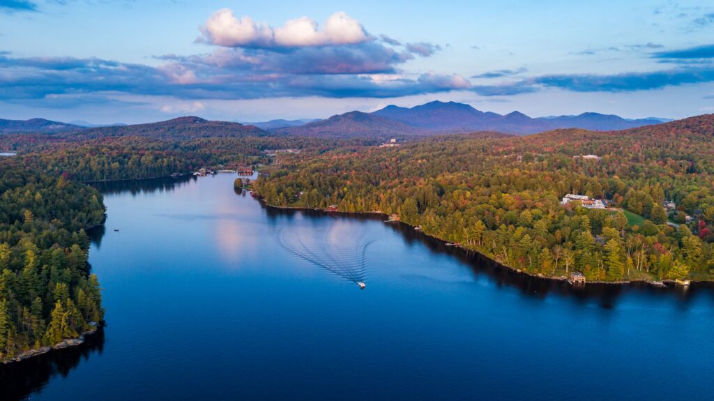
Even with all the restrictions and regulations mentioned above, there are plenty of areas within the Adirondack Park where drones can be operated. This allows drone enthusiasts, photographers, and scientists to capture unique perspectives of the Adirondack landscape and conduct important scientific research. As a photographer, I find drones a valuable tool. The cameras and image sensors found on the higher-end consumer drones allow for the capture of high-quality still images and video. In many cases, the images captured with a drone are superior to what is possible from an aircraft. Drones have minimal vibration and stabilized cameras and can hover in place, making it possible to precisely compose an image and shoot with longer shutter speeds under low light conditions.
Drones also allow scientists and emergency responders to rapidly capture aerial imagery to be used for conservation projects or emergency response. The Ausable River Association has mapped over twenty miles of the river using drones. The imagery captured with a drone typically provides fifty times greater detail than what is available from Google Earth and other satellite-based image services, and several times greater than plane-based image services. The greater detail allows for better project planning and site monitoring. The images can also be used through a technique called photogrammetry to produce three-dimensional models of the areas imaged. Drones can also carry other types of cameras for specific missions. Multi-spectral cameras can be used to rapidly survey crop or forest health, and infrared cameras aid in search-and-rescue missions and wildlife monitoring.
As a wilderness advocate, photographer, and scientist I feel drones offer incredible value in their ability to give us a different perspective on wild lands, conduct new and exciting research, and aid search-and-rescue operations. I also feel it’s important to prohibit their use in the wildest areas of the Adirondack Park so that we maintain some areas of the planet where the spirit of wildness prevails. As with all new technology, society has to find a balance between what is gained and what is lost when it is adopted. With a little discretion and thoughtful limitations on their use, we can find that balance with drone use in the Adirondack Park.
In addition to how he identifies himself above, Brendan Wiltse is the Senior Research Scientist for the Adirondack Watershed Institute and an adjunct faculty member at Paul Smith’s College. He previously worked as the Science & Stewardship Director at the Ausable River Association. Brendan also currently serves as the Associate Director of the Adirondack Lakes Alliance and Vice-President of The Waterman Fund.
Related
Fall Outing 2026
The 2026 ADK Mountain Club Fall Outing, hosted by the North Woods Chapter, will be […]
ADK Fall Outing 2026 Outings
The annual Fall Outing of the Adirondack Mountain Club (ADK) will be held on September […]
ADK Cycle Outing 2026
ADK Cycle Outing will be held June 14–19, 2026 and will again be based at North […]
ADK Trip Planning Sessions
Need help planning your backcountry adventure? Schedule a personal, online session with an ADK staff […]